
// Developers · Civil contractors · Councils
Road, footpath and council asset dilapidation surveys
An infrastructure dilapidation survey records the condition of roads, footpaths, kerbs, drains and other public assets before works start and again when they finish. Every defect is photographed and located, so damage that was already there isn't charged to your project.
// Overview
What is an infrastructure dilapidation survey?
The short answer
An infrastructure dilapidation survey, also called a road dilapidation report, road condition survey or council dilapidation report, is a dated, engineer-signed record of the public assets around a works site. Each existing defect in the road, kerb, footpath, crossovers and drains is photographed and located before works start, then checked again when they finish.
Private dilapidation reports protect you against claims from neighbours. A road and council asset survey does the same job for the street: it shows what the footpath, kerb and road looked like before your trucks, plant and deliveries arrived, so you aren't charged for cracks that were already there.
- Who orders it
- Developers, civil and building contractors, councils and asset owners
- When
- Before works start, and again when they finish
- What's recorded
- Roads, kerbs, footpaths, crossovers, drains, nature strips and street trees
- How defects are located
- By chainage along the route, side of road and nearest address
- Signed by
- A structural engineer (Engineers Australia · RPEQ)
- Quote
- Fixed price within 1–2 business hours, priced on length and assets
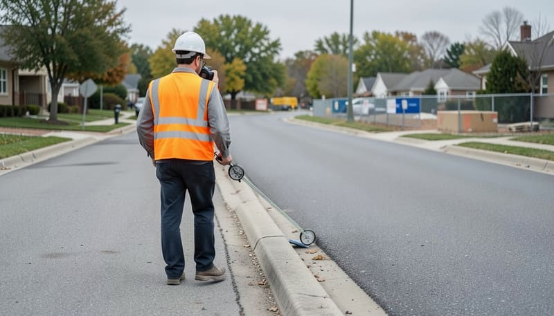 CH 0+000 · BASELINE
Key takeaways
- Survey the street before the first truck arrives, or the baseline is lost.
- Chainage lets anyone find the same defect again.
- A dated record protects bonds and deposits held against damage.
- The after survey uses the same route, so changes are clear.
// What we record
Which roads and council assets do we record?
Everything in the road reserve that your works could damage, recorded so each defect can be found and re-checked in the after survey.
Road pavement
Cracking, potholes, patches, edge breaks and depressions along the frontage and agreed haul routes.
Kerb and channel
Cracked, displaced or broken sections of kerb and channel, including laybacks at crossovers.
Footpaths and crossovers
Cracked, lifted or settled slabs, uneven joints and damaged vehicle crossovers.
Drains and pits
Pit lids, grates and visible surrounds, with any existing damage noted.
Nature strips and street trees
Turf, street trees and tree guards near access points, where vehicles and stockpiles do the most harm.
Street furniture and signs
Signs, poles, bollards and similar fixtures within the survey extent.
Need the neighbouring buildings recorded too? Add them as a pre-construction dilapidation report in the same booking, with one fixed quote for the lot.
// When you need one
When is a road or council asset survey needed?
Whenever your works could damage public assets and someone could later ask who's responsible. Common triggers:
- A consent condition asking for public assets at the frontage to be recorded before works start
- A council asset protection permit or bond held against damage to footpaths, kerbs and crossovers
- Haul routes where trucks and heavy plant will use local streets for months
- Civil and infrastructure works, such as pipelines, drainage or road upgrades beside private property
- Subdivisions and estate works that tie into existing roads and services
- Large building projects with cranes, deliveries and frontage works
Asset protection permits
Many Victorian councils require an asset protection permit before building work starts, often with a fee and a bond. Councils elsewhere may use different names, such as a damage deposit. Check your council's current requirements; our guide explains how asset protection permits work.
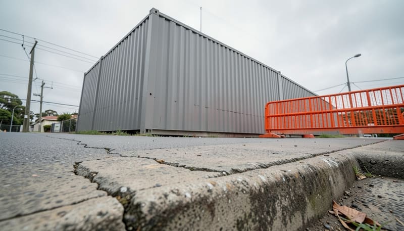
The first truck ends the baseline
Once deliveries, demolition or excavation start, nobody can prove what the footpath and kerb looked like before. Book the survey as soon as your start date is set.
// Method
How are defects located and recorded?
By chainage. Chainage is the measured distance along a route from a fixed start point, so a defect logged at CH 0+145 sits 145 metres from the start. Each defect is also given the side of the road, the asset it's in and the nearest address, which makes it easy to find again months later.
- A fixed start point, described and photographed, so the after survey starts in the same place
- Measured chainage to each defect, with its side of the road
- Dated photographs of every defect, plus overview photos along the route
- A defect log giving each defect's reference, asset, description and approximate size
- An engineer's signature, with the survey extent and any areas that couldn't be accessed
If your contract or council asks for a particular format, such as video of the route, send the wording with your quote request so the scope matches it.
| Ref | Chainage | Asset | Defect | Width | Length |
|---|---|---|---|---|---|
| D-01 | CH 0+012 L | Footpath | Transverse crack | 2 mm | 1.2 m |
| D-02 | CH 0+034 L | Kerb and channel | Cracked section | 4 mm | 0.6 m |
| D-03 | CH 0+058 L | Crossover | Corner break | n/a | 0.3 m |
| D-04 | CH 0+097 R | Road pavement | Longitudinal crack | 3 mm | 4.5 m |
| D-05 | CH 0+145 L | Drainage pit | Chipped lid edge | n/a | 0.2 m |
Every entry links to a numbered photo, so the after survey can check the same defect from the same spot.
// How it works
How does a road and council asset survey work?
Six steps from the survey extent to the final comparison. The first four happen before your works touch the street.
- As soon as works are planned
Define the survey extent
Agree the streets, frontages and haul routes to record from your consent conditions, permit or contract, and mark the start point for chainage.
- Within 1–2 business hours
Get one fixed quote
Receive a fixed price for the before survey, the after survey or both, with survey dates set around your program.
- Before works start
Survey before works start
Walk the route, photograph each asset and log every existing defect with its chainage, side, size and photo reference.
- Before works start
Issue the signed baseline
Receive an engineer-signed report ready to lodge with the council, asset owner or principal contractor.
- When works finish
Survey again when works finish
Repeat the survey along the same route and compare each asset with the baseline, logging any new or changed defects.
- At handover or bond release
Use the comparison
Share the before-and-after comparison when bonds, deposits or damage claims are settled.
Before and after, side by side
| Before survey | After survey | |
|---|---|---|
| When | Before works start | When works finish |
| Purpose | Record existing defects | Find new or changed defects |
| Output | Defect log, photos, chainage | Comparison with the baseline |
- One fixed quote for the before and after surveys
- The same route, start point and chainage both times
- An engineer's signature on every report
- Neighbouring buildings can be added to the same booking
// Who it's for
Who uses road and council asset surveys?
Anyone who could be asked to pay for damage to the street, or who needs to prove that damage was already there.
Developers and builders
Protect bonds and deposits, and meet consent or permit conditions about public assets at the frontage.
Civil contractors
Record roads, kerbs and drains along pipelines, upgrades and haul routes before plant moves in.
Councils and asset owners
An independent, engineer-signed record of asset condition before and after third-party works.
Owners and owner-builders
A frontage record for a single house build, when your council asks for one or holds a bond.
Do
- Survey before deliveries, demolition or excavation start
- Include haul routes your trucks will use
- Send the condition or permit wording with your quote request
- Book the after survey as soon as works finish
Don't
- Rely on a few phone photos without locations
- Forget nature strips, street trees and pit lids
- Let the frontage be reinstated before the after survey
- Assume the council's records will cover you
See how pricing works on our dilapidation report cost page, or read when a dilapidation report is required.
// Related services
Other reports we prepare
Pre-construction dilapidation reports
Record every neighbouring property before demolition, excavation or piling starts.
Learn more After the works · Damage concernsPost-construction reports
Re-inspect after works, compare against the original record and assess likely cause.
Learn more Commercial · Strata · LeasesCommercial and strata reports
Offices, shops, warehouses and strata buildings: adjoining works, lease start and make-good.
Learn more// Questions
Road and council asset survey FAQs
Still unsure? Call 07 2150 0579 and an engineer will talk it through.